Tonight: Another peaceful night with temperatures in the low 50's with mostly clear skies. Lower cloud coverage for the evening/early Friday morning will bring about great viewing conditions for nighttime total lunar eclipse (Blood Moon). It will be partially covered by 1:09 a.m. before transitioning into full coverage at 2:26 a.m. Perfect weather this evening with soft breezes tonight.

Tomorrow: Great day to eat a pie. Temperatures increasingly getting warmer as the day continues blasting from low 50's in the morning to high 70's by the evening. Regions of Indiana will be put under a wind advisory from tomorrow into Saturday evening. These winds will increasingly start to pick up throughout the day into evening. As we head into the evening, near record high temperatures and moisture will combine for a volatile weekend environment.

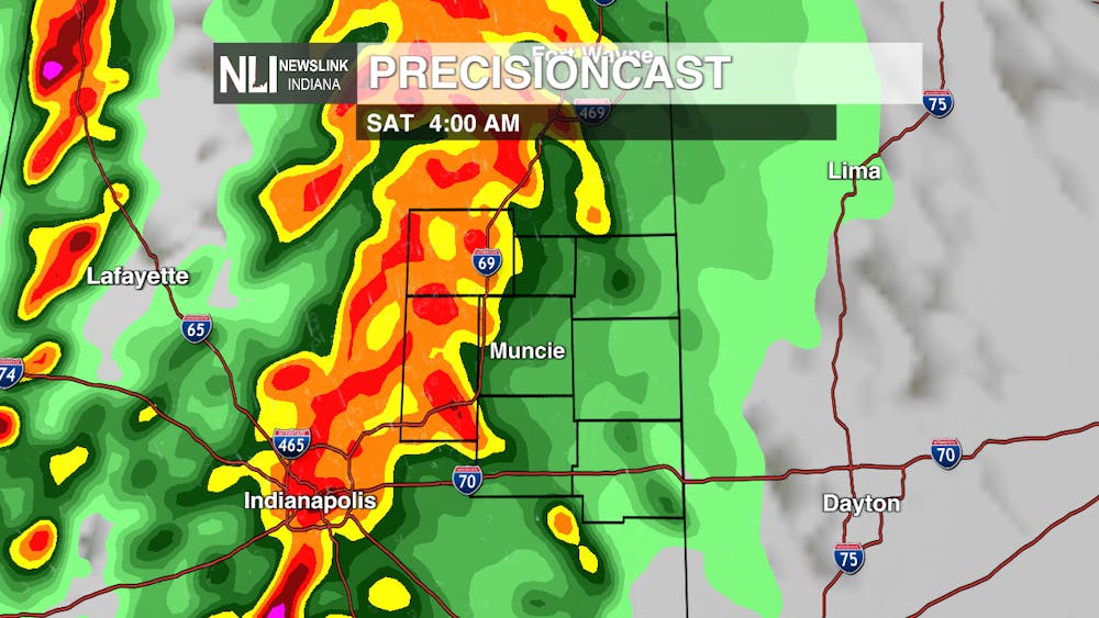
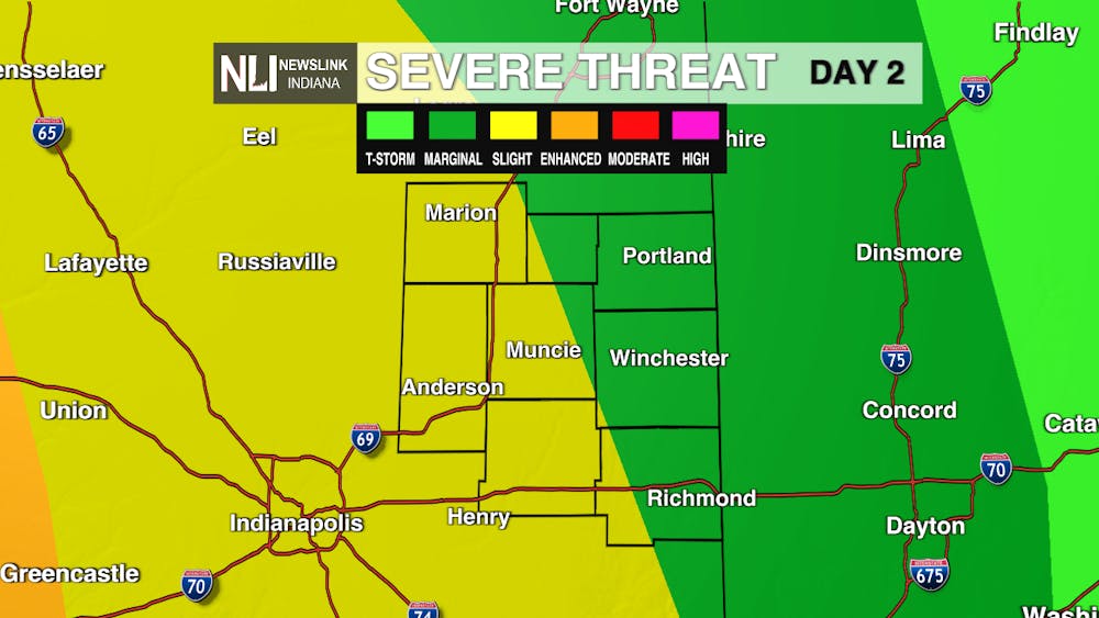
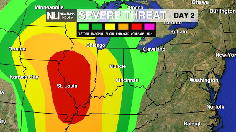
Weekend: Heading into Saturday morning this unstable environment will bring about severe weather. The SPC has issued both a marginal (Level 1) and a slight (Level 2) risk within the Delaware County boundary. This will produce isolated storms with possible hail and wind damage. The risk of a tornado is low but the ingredients for it are there. The system will continue to move through our area for most of Saturday, weakening out through evening into early Sunday morning. Due to this storm system passing through the temperature will drop drastically on Sunday in the high 40's. Scattered showers will be about Sunday morning turning into overcast for the remainder of the day.
Seven-Day Forecast: Spring weather is finally making an appearance as temperatures trends have shifted from high 30's to mid to high 50's. We end this work week with high 70's. Sunday will be our lowest temperature of 48 degrees, but temperatures will increase into next week. Thunderstorms and rain showers will make an appearance these next seven days, but for a majority of the week we will see more sun. St. Patrick's Day will have the most sun exposure. As we continue into next week, temperatures will warm back up into mid 60s by the middle of the work week.

-- Weather Forecaster Rachel Fulton
Follow us on Twitter @NLIWeather for breaking weather updates.
NewsLink Indiana is a proud Ambassador for the NOAA Weather-Ready Nation program.
For more information about the Weather-Ready Nation program please click HERE .
The Daily News welcomes thoughtful discussion on all of our stories, but please keep comments civil and on-topic. Read our full guidelines here.