A significant winter storm is expected to impact East Central Indiana over the next 36-48 hours, bringing several inches of snow, gusty winds, and arctic cold temperatures behind it.
Currently, several winter weather alerts are in effect for portions of East Central Indiana:
- A Winter Storm Watch remains in effect for Blackford, Grant, and Jay counties until 1pm Monday afternoon.
-A Winter Weather Advisory remains in effect for Delaware, Madison, and Randolph counties until 1pm Monday afternoon.
-A Winter Storm Warning is in effect for Henry and Wayne counties until 1pm Monday.

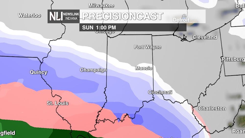
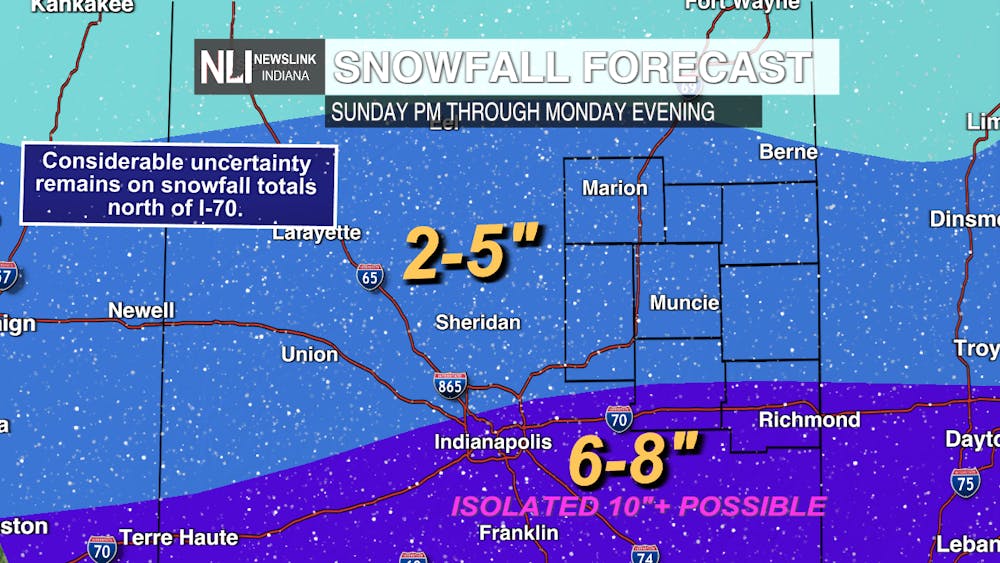
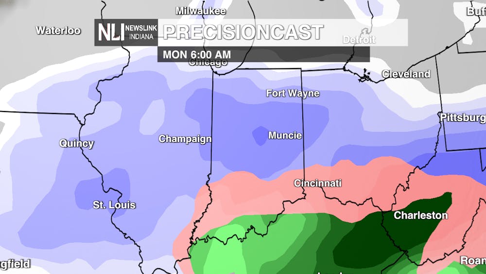
Current thinking as of Saturday morning shows snowfall entering the region around lunchtime Sunday, with snowfall continuing throughout Monday afternoon before tapering off in the evening hours. Models over the last 24 hours have shifted the heaviest snowfall south of I-70, where isolated double digit totals are possible in south central Indiana.

Overall, much of our region can be expected to see 2-5" of snowfall, with heavier impacts further south. The most dominant precipitation type looks to be snowfall, with much of the ice remaining well to our south. Travel will likely remain difficult for at least a few days, as temperatures behind the storm will be cold enough to prevent much of the snow from melting.

This will likely be Central Indiana's heaviest snowfall in the last 2-3 years, so now is the time to prepare for the storm and charge devices, winterize homes and vehicles, and be prepared if you were to lose power. Models can still shift back northward over the next day, and this is the type of storm where only 10-20 miles difference can have drastic impacts on conditions.
- Chief Weather Forecaster Noah Gordon
Follow us on Twitter @NLIWeather for breaking weather updates.
NewsLink Indiana is a proud Ambassador for the NOAA Weather-Ready Nation program.
For more information about the Weather-Ready Nation program please click HERE


The Daily News welcomes thoughtful discussion on all of our stories, but please keep comments civil and on-topic. Read our full guidelines here.